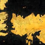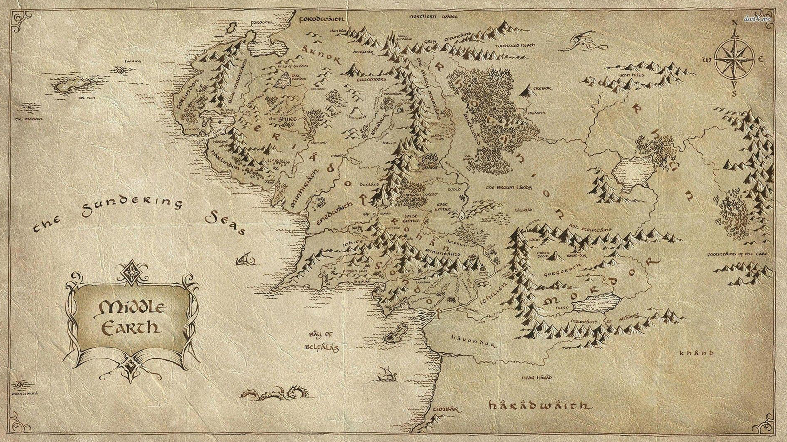
In the expansive tapestry of J.R.R. Tolkien’s “The Lord of the Rings,” the Middle Earth map stands as a cartographic masterpiece, intricately detailing the vast and diverse landscapes that serve as the backdrop to the epic saga. Stretching from the Shire in the west to the dark realms of Mordor in the east, the map is a visual representation of Tolkien’s rich imagination and meticulous world-building. The Misty Mountains loom majestically in the north, while the great forests of Fangorn and Lorien add an ethereal touch to the central realms. The intricate river systems, including the Anduin and its tributaries, carve through the terrain, connecting the varied realms and setting the stage for the fellowship’s perilous journey.
The cities and strongholds scattered across the map, from Rivendell’s elven refuge to the imposing towers of Isengard and Minas Tirith, provide a sense of the cultural diversity and historical depth embedded in Middle Earth. The foreboding Black Gate of Mordor and the serene beauty of the Gladden Fields are captured with equal attention to detail. Tolkien’s meticulous approach to geography extends beyond physical landmarks; he weaves a narrative into the very fabric of the map, creating a sense of history and mythology that transcends the pages of the novels. The Middle Earth map is not merely a navigational tool; it is a visual companion to the profound tales of heroism, friendship, and the eternal struggle between light and darkness that unfold within the pages of “The Lord of the Rings.”